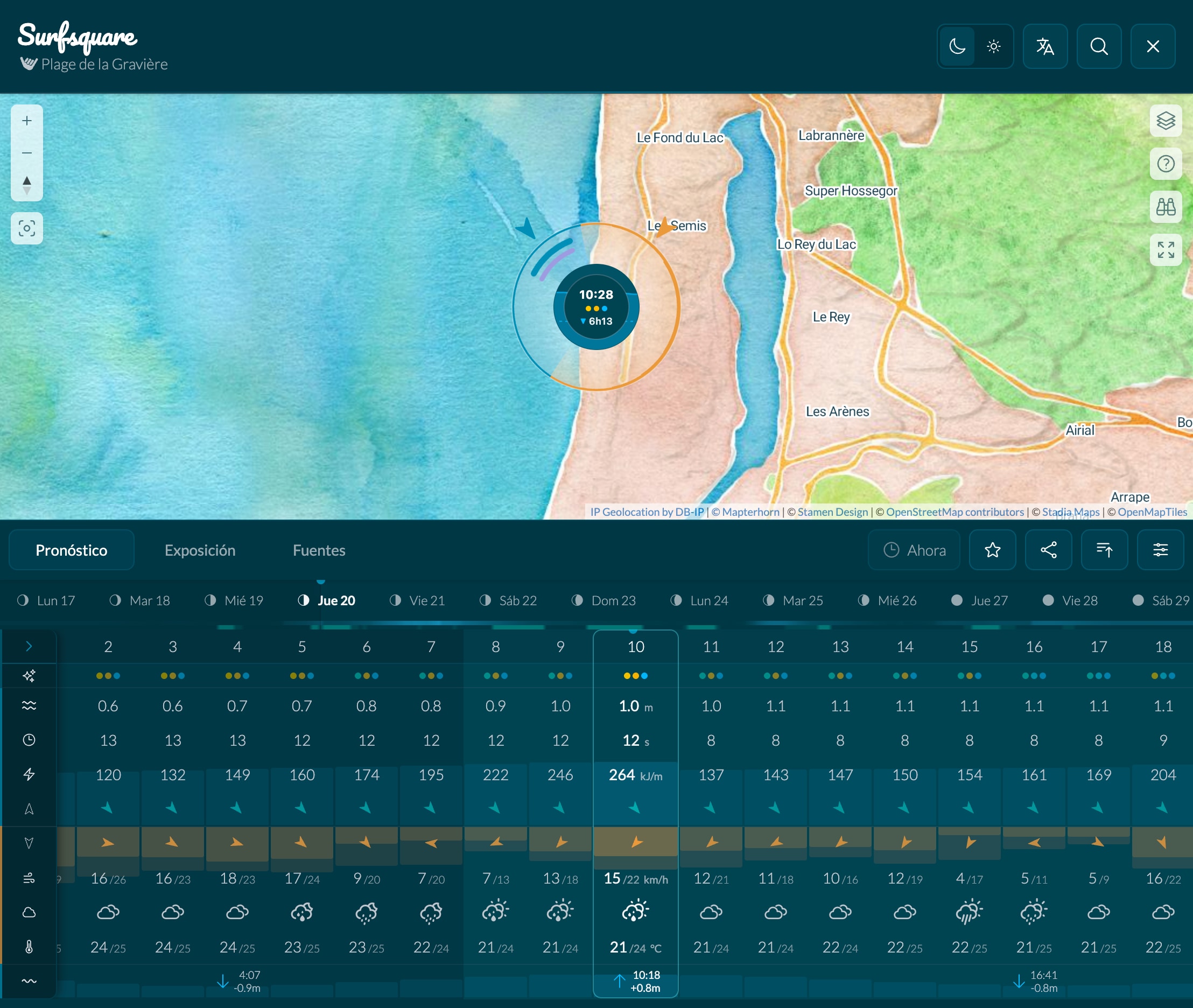
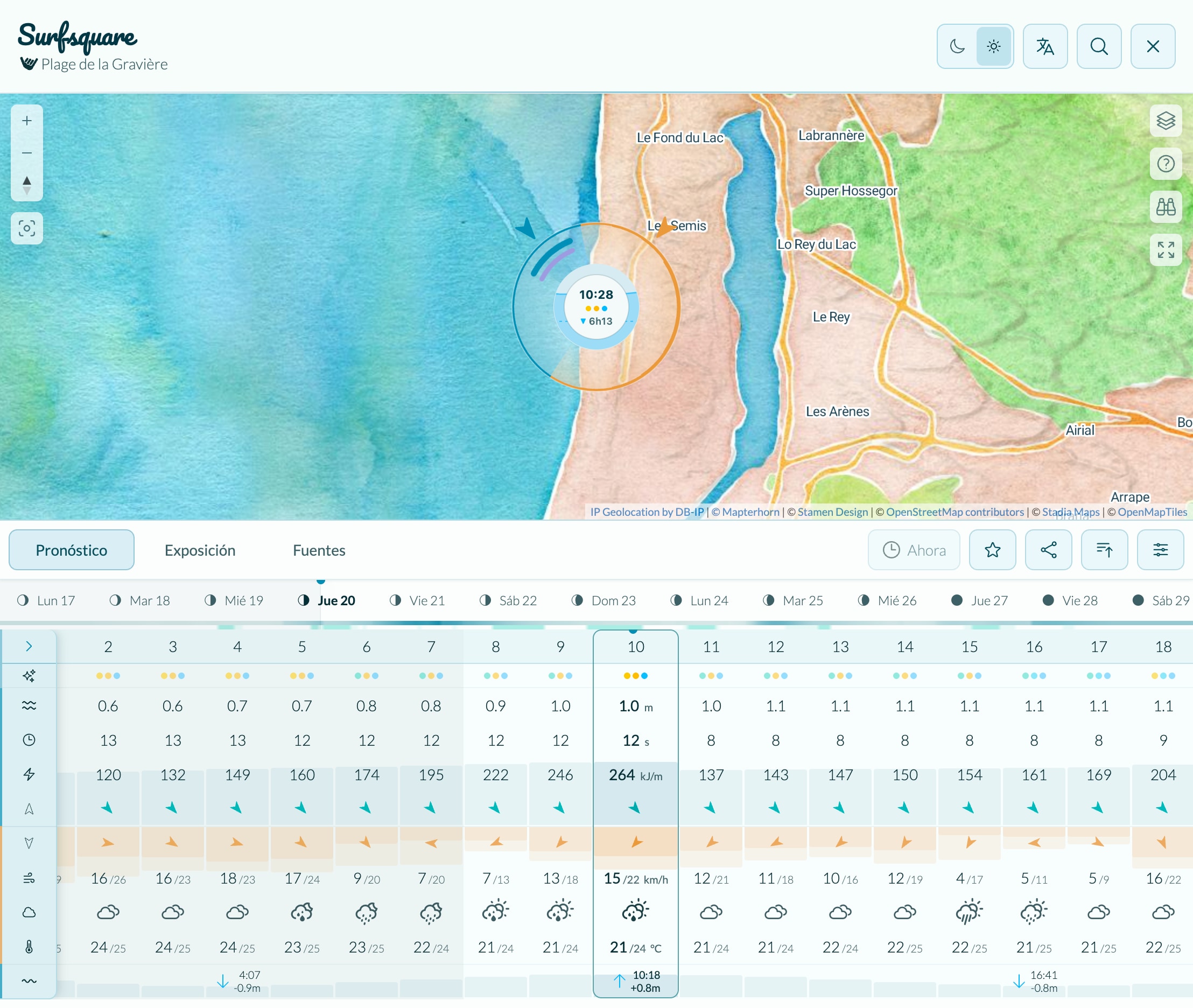
Know the Swell.
Plan Your Session.

See where swell can reach and how nearby terrain shelters the wind, alongside 10-day wave forecasts for any coast on Earth.

Global coverage
10-day forecasts
Hourly resolution
Free access

Plage de la Gravière  ·  Hossegor, France  ·  One of Europe's heaviest beach breaks

Forecast length
10 days
Beaches & breaks
40k+
Forecast resolution
Hourly
Cost
Free

Read the Ocean at a Glance

Each panel below decodes one piece of the forecast.

Once you know what to look for, the whole picture snaps into focus.

✦ Pro Tip

Day Energy & Surface Gradients

Two thin gradients below each day turn the 10-day forecast into a visual scan. The top bar compares wave energy across the forecast: brighter cyan means more energy. The lower bar shows surface cleanliness during daylight: stronger teal means cleaner water, while faint or empty sections mean mixed or choppy. Look for both signals lining up, then inspect those hours.

Mon
Tue
Wed
Thu ✦
Wave energy
Surface quality
Less More

Wave Power

Height, period, and energy (kJ/m) work together. A 1.5 m wave at 14 s can carry far more punch than a 2 m wave at 6 s. A long period (12 s+) usually means clean groundswell, while a short period (≤ 8 s) points to weaker local wind chop.
1.5 m · 14 s 78 kJ/m
2.0 m · 6 s 22 kJ/m

Bigger isn't stronger. The longer-period wave packs more punch.

Exposure Analysis

New
Open the Exposure tab to inspect every direction around a spot. Blue shows open-water fetch, orange begins at the first land barrier, and a thicker boundary means higher terrain that can shelter the wind.
N NE E SE S SW W NW
  • Open-water fetch
  • Land beyond barrier
  • Stronger terrain shelter
  • Weaker terrain shelter

Wind Shelter

New
Surfsquare scans nearby terrain in every direction to show how sheltered a spot is. A thicker radar rim means stronger shelter from that direction. When terrain shelters the selected spot, the orange wind arrow appears outlined.
  • Sheltered wind
  • Stronger terrain shelter
  • Weaker terrain shelter
  • Here: high terrain blocks the wind

Tides

The radar center is the tide gauge. Water rises and falls inside the ring, and the dashed line marks how high or low the next tide will reach. Many breaks only work at specific tides. A high tide can drown a sandbar, while a low tide can expose a dangerous shallow reef.
  • Current tide level
  • Heading to next high/low
  • ▲▼ Time to next high/low
  • Here: from low to high tide

Swell Composition

The arcs on the radar outer ring break swell down into primary, secondary, and wind-wave components. Multiple trains from different directions at once often produce crossed, unpredictable surf, which is harder to ride and potentially more hazardous.
  • Primary swell
  • Secondary swell
  • Wind wave
  • Longer arc = more energy

Insights

Experimental
These indicators summarize what matters for that exact hour at a glance. They combine surface quality, period consistency, and exposure so you can spot the best times to surf before diving into every raw number. Cool blue tones mean better conditions and warm red tones mean worse.
Surface
  • Clean
  • Mixed
  • Choppy
Consistency
  • Organized
  • Mixed
  • Messy
Exposure
  • Full
  • Partial
  • None

Keep the surf check one tap away

Pin Surfsquare to your home screen and it opens straight to the surf map, like a real app. Perfect for a quick check from the car park before you suit up.

iOS In Safari, tap Share, then Add to Home Screen.
Android Open the browser menu, then tap Install app.

Important Information & Disclaimer

Forecast accuracy. Ocean, weather, and tide data come from numerical forecast models and are provided for informational purposes only. Real ocean conditions can differ significantly from model predictions. Always verify with local knowledge and additional sources before entering the water.

Beach reference points, not verified surf spots. Locations in Surfsquare are geographic coastal features such as beaches, reefs, and headlands from open mapping data. They serve as reference points for swell analysis only. The presence of a location does not imply it is suitable, safe, or legally accessible for surfing.

Your safety is your responsibility. Ocean conditions change rapidly and without warning. Rip currents, submerged rocks, marine life, vessel traffic, and local regulations are not shown. Never surf beyond your skill level, always surf with others, and respect local rules and the environment.

Surfsquare is provided "as is" without any warranty. The creators accept no liability for decisions made based on data displayed in this application.